The standard U.S. map shows states laid out in two dimensions, but doesn’t convey any information about the crucial third dimension: altitude.
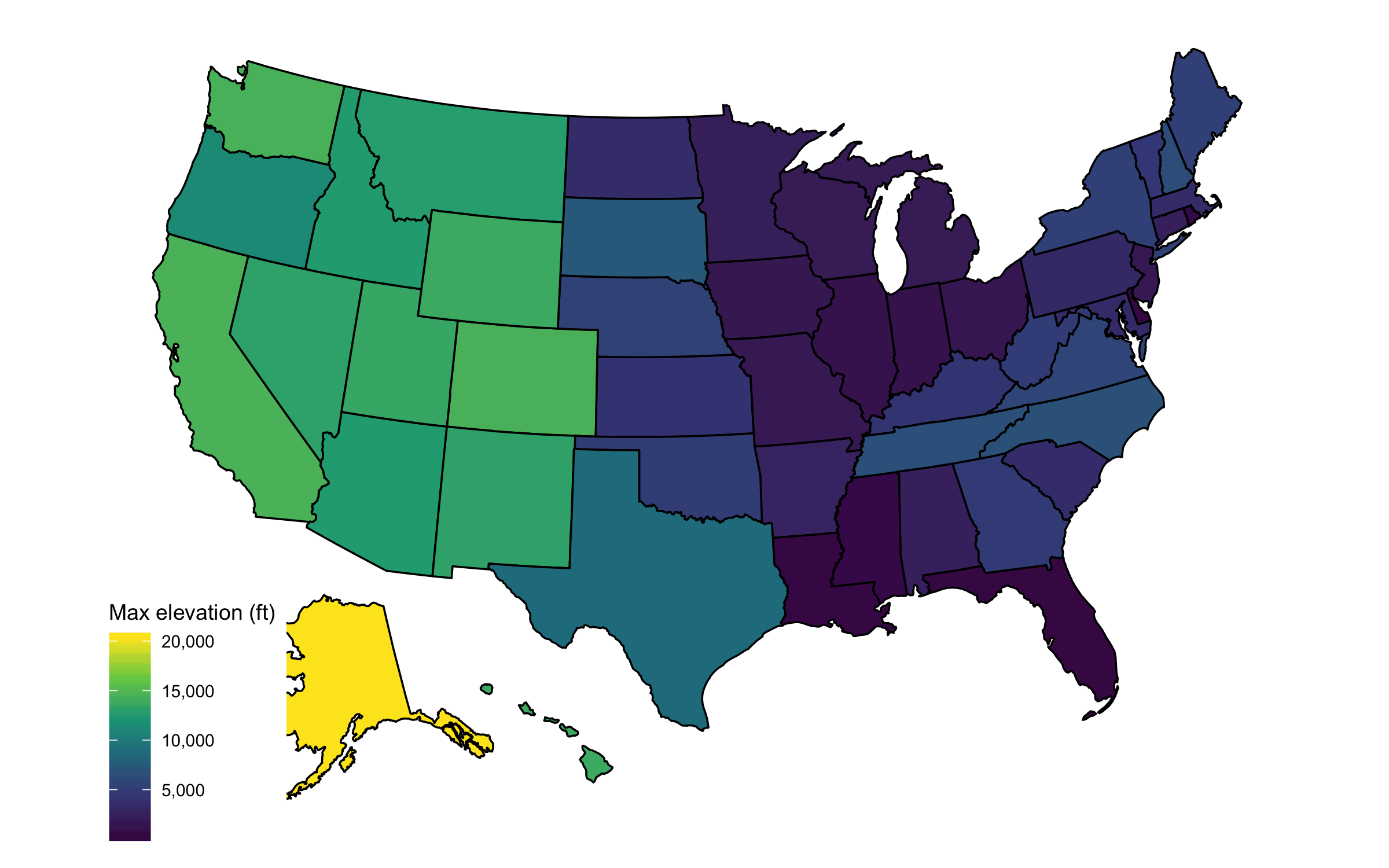
So here are some maps to rectify that. There’s nothing very surprising here, except perhaps how clear of an East-West divide there is in maximum altitude.
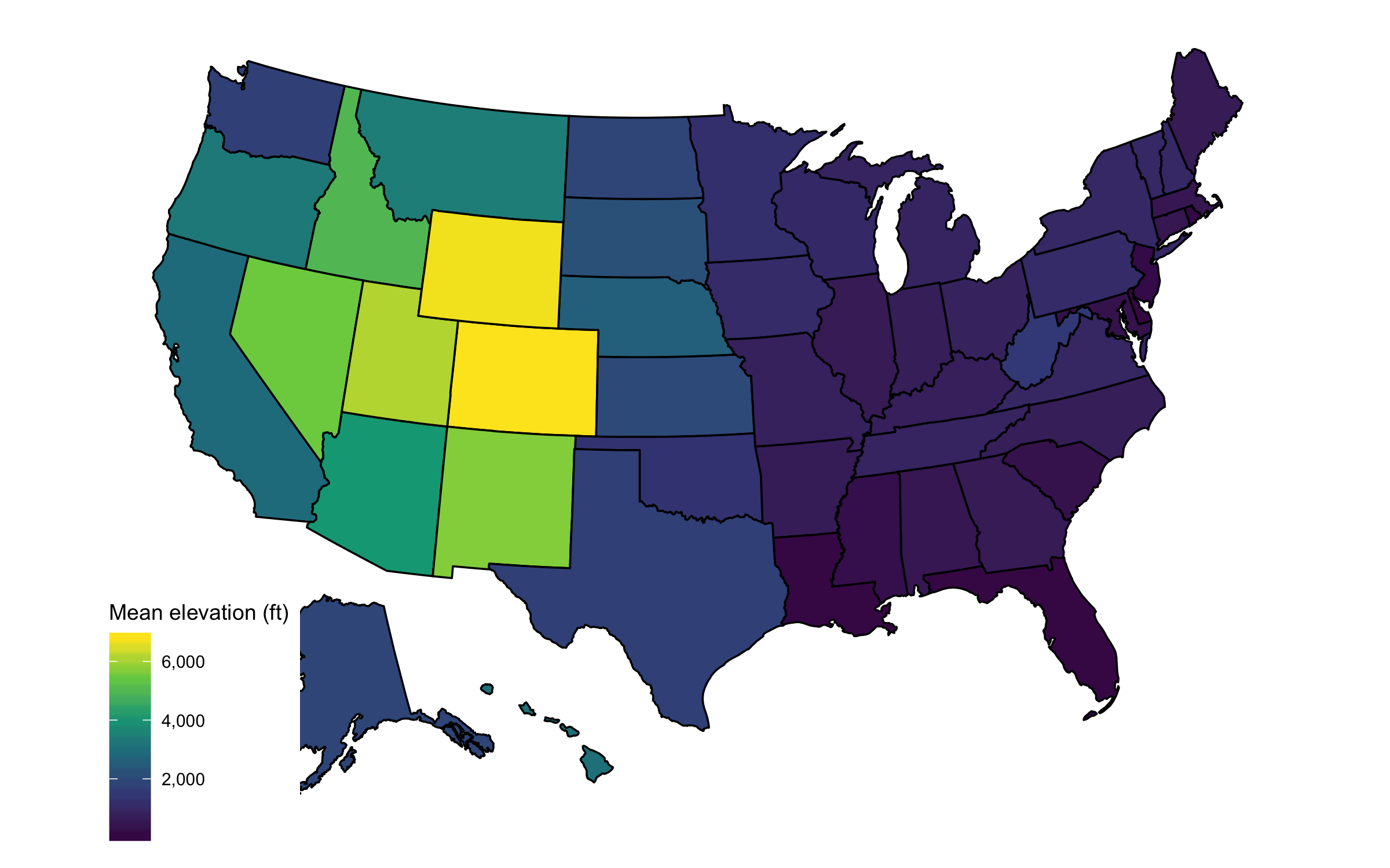
Mean elevation
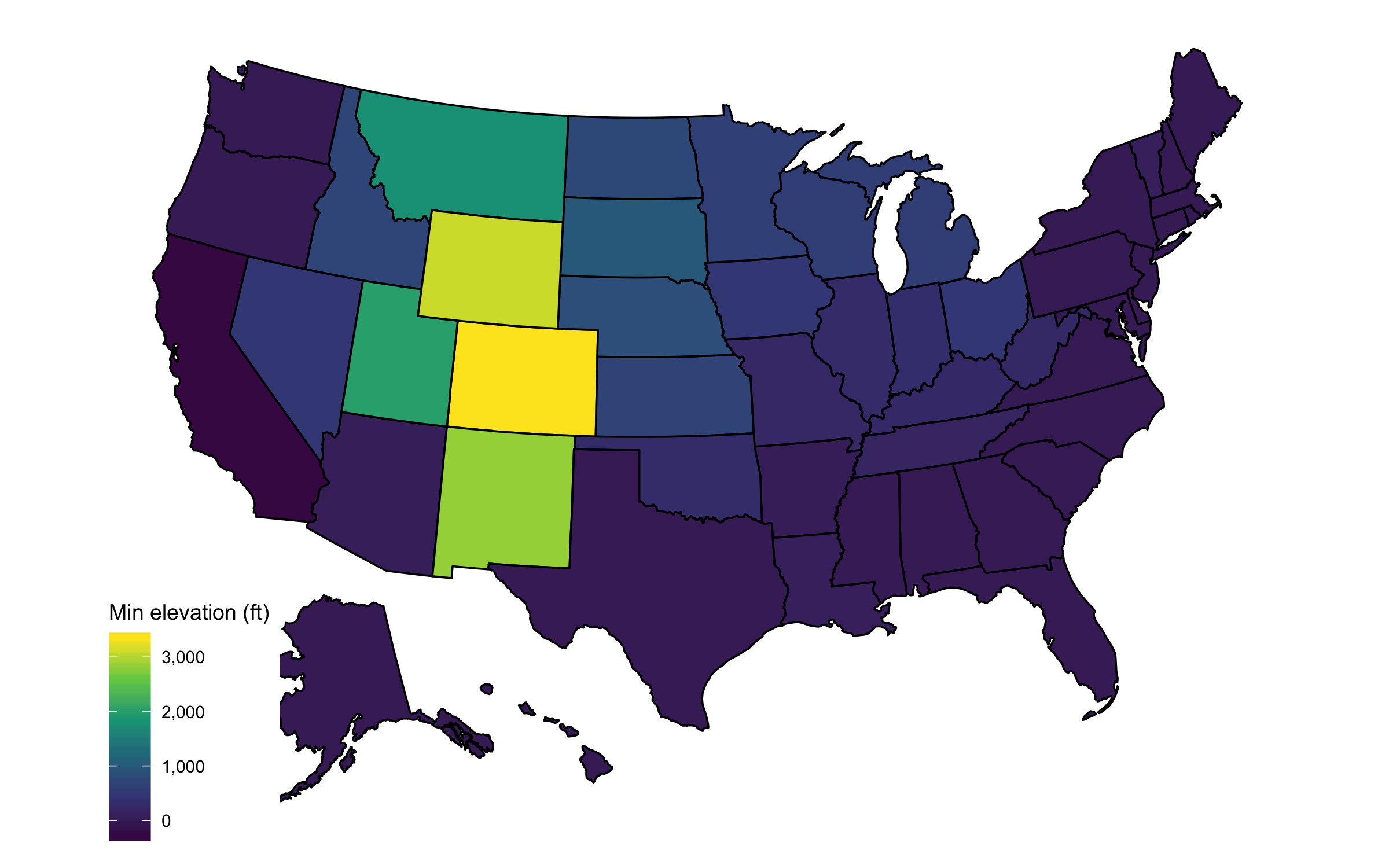
Minimum elevation
This map shows the Continental Divide most clearly.
Maximum elevation
Here, the Mississippi River basin stands out in the darker colors of the Midwest
states.
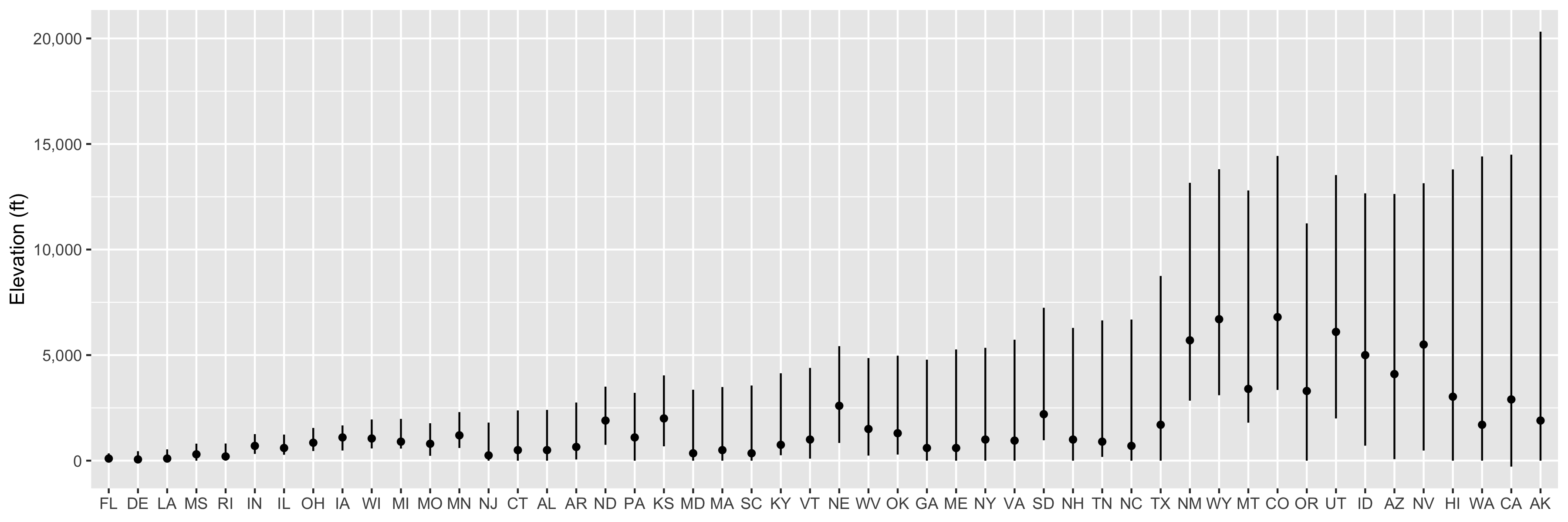
Elevation profiles
And last, everything on one chart. Lines show the elevation range, and dots are the mean elevation.